
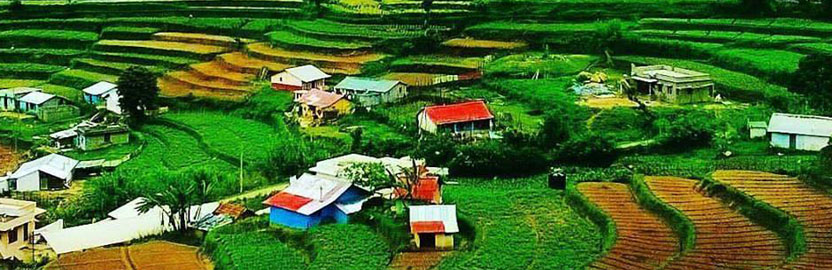
VATTAVADA IN MUNNAR
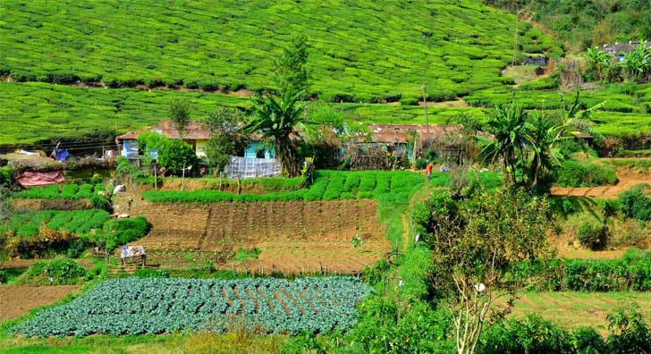
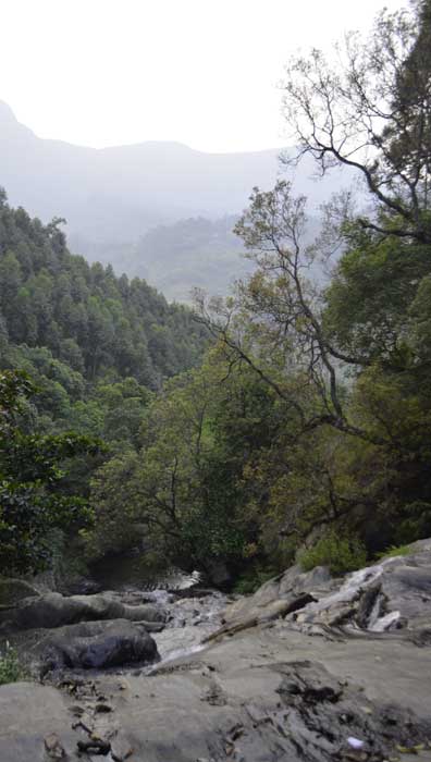
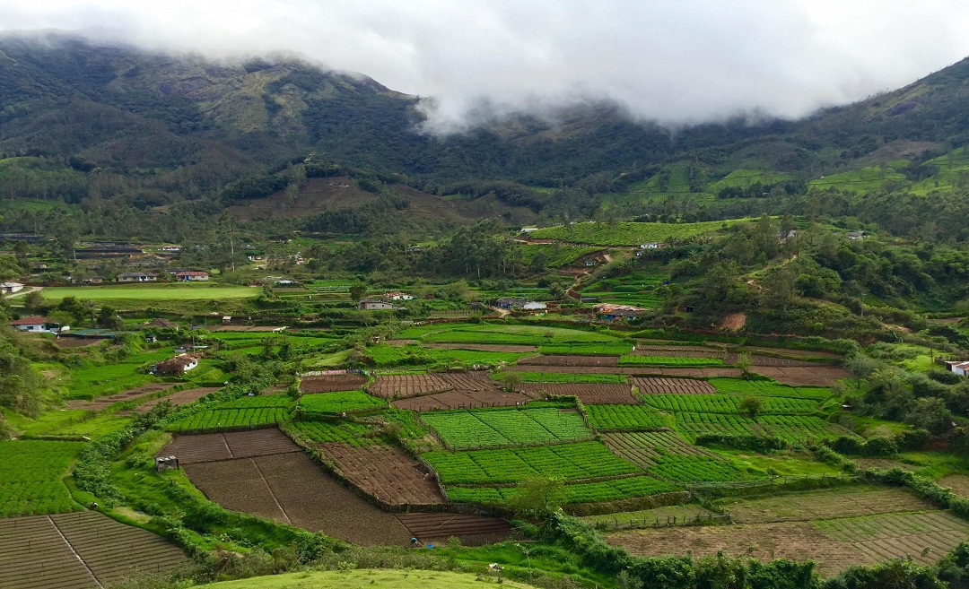
Shola County located about 45 km east of Munnar is the serene village of Vattavada. At Vattavada, in comparison to other regions in Munnar, instead of tea plantations, it is the predominance of vegetables that occupy the terraced slopes and valleys of Vattavada. The scenic hilly tract of Vattavada is at an altitude of 6500 feet above sea level, and is a refreshing experience, which is yet to come under the constant gaze and the footprints of visitors. The place receives plenty of sunshine and the winter temperatures never dip below unbearable levels. Besides the slopes of vegetable fields, one could also find forest patches, interspersed with eucalyptus and conifers. The area also teems with bird life and also other winged beauties like butterflies in various color, size and shape. Vattavada could be taken for a place significant for trekking. Here, an avid trekker would get options to explore many adjoining locations. Some of the trekking routes starting from Vattavada include the ones going to Kodaikanal, Top Station, Mattupetty, Kanthaloor and Meesapulimala. Most of these treks offer enough excitement in terms of negotiating the terrain as well as enjoying the floral and faunal wealth on its course. Visitors could also engage in activities like mountain jeep safari, mountain biking, jungle camping etc. offered by private operators in the region. The local populace of Vattavada has a significant number of tribals. Their way of life, art forms, language, natural remedies are some of the other interesting aspects that could be of interest to visitors coming to Vattavada.

Getting there
Nearest railway station: Ernakulam Junction, about 130 km away from Munnar.
Nearest airport: Cochin International Airport, about 110 km away from Munnar.
Geography and Climate:
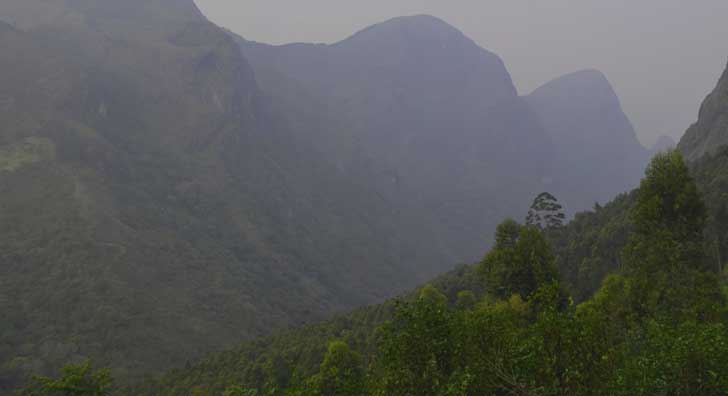
Vattaada is a virtually rain shadow village, lying in the eastern side of the Western Ghats near to Marayur and north side of Munnar.The region in and around Vattavada varies in height from 1,450 meters (4,760 ft) to 2,695 meters (8,842 ft) above mean sea level. Vattavada enjoys a salubrious climate. The temperature ranges between 5 °C (41 °F) and 18 °C (64 °F) in winter and 12 °C (54 °F) and 20 °C (68 °F) in summer. Temperatures as low as −4 °C (25 °F) have been recorded in the border region of Vattavada. The mean maximum daily temperature is at its lowest during the monsoon months with the highest temperature being 19 ° C.

Crops :
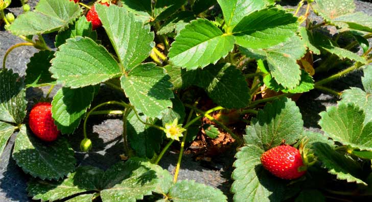
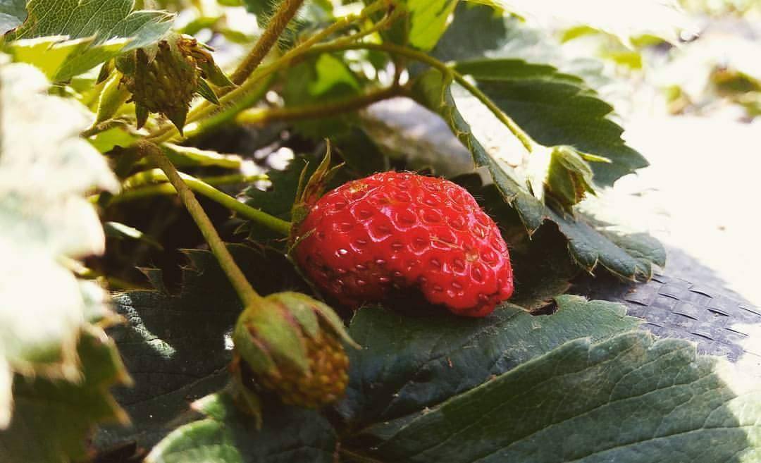
Vattavada is known as the market of Kerala, because they are in the forfront of vegetable producing. Vattavada is famous for its wide variety of crops which is not seen on the other parts of Kerala, which includes varieties of apple, orange, strawberry, blackberry, plums, gooseberry, egg fruits, peach and passion fruits, avocado etc.

Flora and fauna :
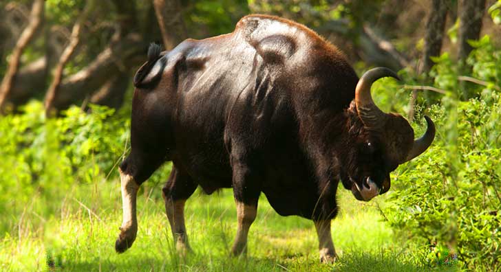
Most of the native flora and fauna of Vattavada have disappeared due to severe habitat fragmentation resultant from the creation of the plantations. However, some species continue to survive and thrive in several protected areas nearby, including the new Kurinjimala Sanctuary to the east, the Chinnar Wildlife Sanctuary, Manjampatti Valley and the Amaravati reserve forest of Indira Gandhi Wildlife Sanctuary to the north east, the Eravikulam National Park and Anamudi Shola National Park to the north, the Pampadum Shola National Park to the south and the proposed Palani Hills National Park to the east. These protected areas are especially known for several threatened and endemic species including Nilgiri tahr, the grizzled giant squirrel, the Nilgiri wood-pigeon, elephant, the gaur, the Nilgiri langur, the sambar, and the neelakurinji (that blossoms only once in twelve years) and special thing is that it is the center for Munnar, Kodaikanal and Marayur.
Places To Visit :
Join us for an out of the ordinary experience on and off the beaten track combining the mainstream tourist sites with the unexplored best that Nature has to offer. Explore some of the following must see tourist attractions near Shola County Resorts, Munnar.


Strawberry Farms at Vattavada :
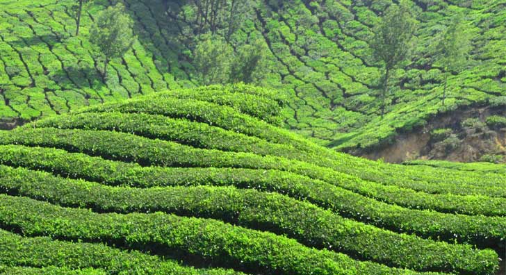
MUNNAR (40 kms from Shola County)
Across the expanse of thirty sprawling tea estates, discover Munnar – Kerala’s premium hill station.
TOP STATION (a view point 7 kms from Shola County) :
At 2200m above sea level , this is the highest point on the Munnar -Kodiakanal road offering a panoramic view of the neighbouring state of Tamil Nadu. The rare flower ‘Neelakurunji’ (strobilanthus) belongs to this region.
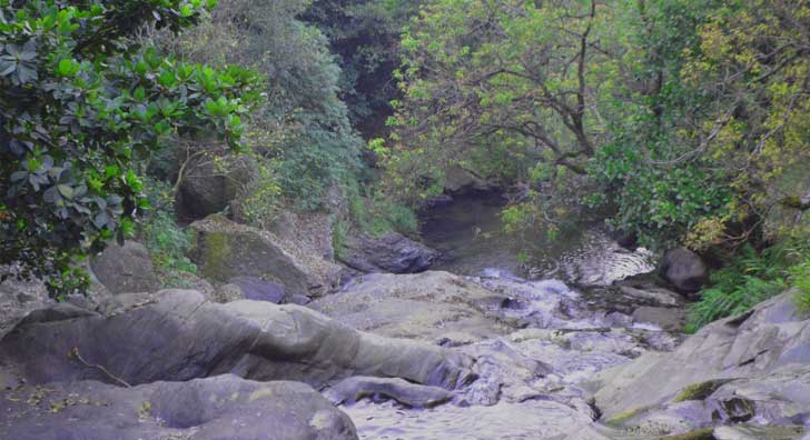
PAMPADUM SHOLAY NATIONAL PARK (4kms from Shola County) :
Pampadum Shola National Park is the smallest national park in Kerala state, South India.The park is administered by the Kerala Department of Forests and Wildlife, Munnar Wildlife Division, together with the nearby Mathikettan Shola National Park, Eravikulam National Park, Anamudi Shola National Park, Chinnar Wildlife Sanctuary and the Kurinjimala Sanctuary. The park adjoins the Allinagaram Reserved Forest within the proposed Palani Hills Wildlife Sanctuary and National Park. The Western Ghats, Anamalai Sub-Cluster, including these parks, is under consideration by the UNESCO World Heritage Committee for selection as a World Heritage Site. The name´"Pampadum Shola" means, "the forest where the snake dances", derived from three Tamil (one of the Dravidian languages) words, "paamp", which means "snake"; "aattam", means "dance"; and "cholai", means "forest". "Shola" may be considered as a mis-speller of "cholai". The park protects a moderate amount of montane evergreen shola forest that is associated with the wildlife rich Eravikulam National Park
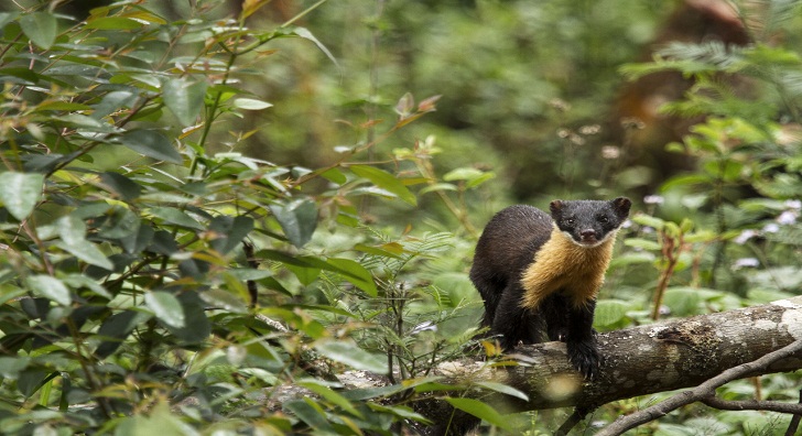
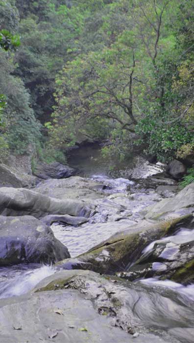
There are various types of medicinal plants (herbs), of which studies have been made. After the forest range there are grandis (a variety of eucalyptus) that threatens the ecology of the area due to its dehydrating and quick-spreading character. These trees as well as the private legal and illegal plantations of the same trees remain as a living danger. The eucalyptus trees (grandis) that eat up the unique eco-system is yet to be a consideration of the forestry. The national park with its unique richness of uncontaminated "humus", has been an interest of studies recently. The keystone species here is the highly elusive and endangered, endemic small carnivore - the Nilgiri marten.Leopards and Indian wild dogs are sometimes sighted at dusk or dawn, tigers are an important animal of the park. The Old Kodaikanal–Munnar Road nearby is closed due to the growing population of wildlife such as elephants, buffaloes gaur and Nilgiri langurs. Some notable birds found here include the Nilgiri wood-pigeon, white-bellied shortwing, vernal hanging parrot, blue rock-thrush, blue-capped rock-thrush and Nilgiri flycatcher, and black-and-orange flycatchers.
The Forest Department provides opportunity to experience the beauty of Pampadum Shola National Park to the curious tourists and research fellows. A special welcome board is placed at the entrance of the National Park, at the Check-post, which is 7 km before reaching Vattavada. These days the National Park is open to the tourists with payment, and the accompaniment of the forest officers, for the safety of the forest as well as of the people. The evergreen trees and the water sources become the habitat of various birds and animals. This thick green forest is situated almost 35 km away from Munnar, towards the road to Koviloor and Vattavada.
MATTUPPATTY DAM (21 kms from Shola County) :
Built in 1953 with a total length of 297 feet and a catchment area of 105 million cubic feet, the lake created by this dam provides a picturesque picnic spot. Speed launches and slow speed motor boats are available on hire
KUNDALE DAM (13 kms from Shola County) :
This 850-foot long dam was constructed over 100 years ago during the 25th year of the reign of the Maharaja of the state of Travancore. With a reservoir capacity of over 250 million cubic feet of water, this dam is a symbol of engineering excellence that has endured for more than a century
ECHO POINT ( 5 kms from Shola County):
What is really intriguing about this place is the fact that the echo can be heard only if you face the trees in a perpendicular direction and not if the sounds are directed at the trees in an angular direction. This makes it an interesting diversion en route to Top Station.
KODAIKANAL (57 kms from Shola County) :
At an altitude of about 2,133-m and covering an area of 21.45-sq-km, Kodaikanal is located amidst the folds of the verdant Pali hills and is one of the most popular hill stations in India. This little hill town is renowned for its educational institutions of international repute
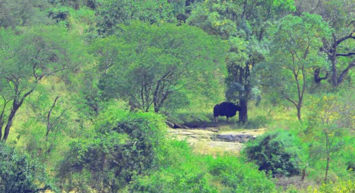
RAJAMALAI SANCTUARY (17 kms from Munnar) :
This wildlife sanctuary is home to the Nilgiri Tahr – a rare species of mountain goat whose numbers exceed a little over 1300. Half the world’s population of this rare species of mountain goat or Tahr, which is fast becoming extinct, is now found here.
DEVIKULAM ( 7 kms from Munnar) :
Devikulam boasts of picturesque settings against the backdrop of its velvet lawns. The Sita Devi Lake situated here is an ideal picnic spot with its pristine surroundings, mineral water, and trout-fishing facilities.
ANAMUDI (25 kms from Munnar):
The highest peak in South India ( 2695 m above sea level) and an ideal spot for trekking.
MARAYOOR (40 kms from Munnar):
One of the only places in Kerala where the natural foliage is the abundant growth of sandalwood trees, Marayoor boasts of a children’s park extending across one hectare of land under the canopy of a single Banyan tree along with many natural caves with murals and priceless relics from the latter part of the Stone Age civilization